From Sciarborasca to the ridge
From the hamlet of Sciarborasca a CAI trail climbs to the watershed ridge and the Alta Via dei Monti Liguri. Tough elevation, rewarded with simultaneous views of the sea and the Po Valley. Hiking shoes mandatory.
Search by name, keyword or phrase. Results from articles, FAQ, pages and listings.
Cogoleto is one of the few places in Italy where in half an hour you go from beach to the 1,287 m of Mount Beigua — a UNESCO Global Geopark.
The village is an ideal base for combining sea and mountain in the same day. The coast offers swimming and a flat coastal cycle path; inland the Beigua mountains lead to CAI trails, internationally significant geosites and the remains of the ancient Ligurian road network. In between, the historic caruggio for the hottest hours.
The Parco Naturale Regionale del Beigua has been a UNESCO Global Geopark since 2015: over 39,000 hectares between sea and Apennines, with internationally significant geosites (ophiolites, eclogites, pre-Cambrian formations). Cogoleto is one of six municipalities facing the park from the sea; from the centre you head straight up to the ridge.
From the hamlet of Sciarborasca a CAI trail climbs to the watershed ridge and the Alta Via dei Monti Liguri. Tough elevation, rewarded with simultaneous views of the sea and the Po Valley. Hiking shoes mandatory.
The classic if you want the summit. From the hamlet of Lerca a historic mule path climbs into the park's trail network. The summit (1,287 m) is one of the few Italian points with sea and Alps in the same view on clear days.
Easy valley-floor walk along the Lerone stream (on the Arenzano border). Almost flat, shaded, doable even in summer when ridge trails are too hot. Starting point reachable by car from Cogoleto.
A piece of ancient Jurassic ocean floor lifted to the surface by tectonics. The green rocks of Beigua are one of the reasons for the UNESCO recognition. Visible along many trails in the park; the most spectacular sections are on the Cogoleto and Varazze side.
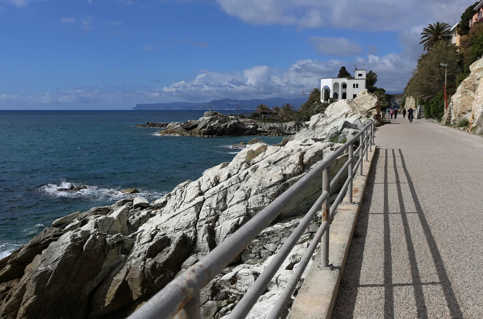
Seven flat kilometres between Arenzano, Cogoleto and Varazze, on the bed of the abandoned railway. Well-kept gravel, lit tunnels, viaducts above hidden coves. Suitable even for small children, no cars, no climbs.
In summer some sections become pedestrian-only during busy hours — check the municipal ordinance. Bike rental is available near Cogoleto station. Details, cove stops and photos: the beaches page.
Narrow alleys between fishermen's houses, the Christopher Columbus plaque at Via Rati 64, focaccia bakeries, artist ateliers and small galleries. Walkable in twenty minutes if you never stop — an afternoon if you taste and really look.
The village's restored Baroque parish church, with a bell tower visible across the whole bay. Open during regular service hours; those interested in sacred art can ask the priest about side-room access.
The excellent water, sheltered position and varied seabed make Cogoleto a good base for SUP (flat sections in the morning), sea kayaking to the Lungomare Europa coves, snorkelling over the rocky shallows at each end of the coastline. Sailing is hosted by the clubs at Arenzano and Varazze, 3 and 7 km away — Cogoleto has no marina but is reachable from sea by tender.
Cogoleto pairs a working seaside borgo with the mountains behind it: swim along the 2.5 km seafront, wander the old caruggi and the house linked to Christopher Columbus, eat focaccia and bagnun, then hike into the Beigua UNESCO Global Geopark right above town.
Genoa is about 30 minutes away by train; Arenzano and Varazze are a few minutes along the coast. Above the town lies the Beigua Natural Park, a UNESCO Global Geopark, with trails and sea-view viewpoints.
To send a postcard, leave a review, or vote on a poll, please sign in. Cogoleto never sells your data and never sends promotional emails.
To continue, confirm you have read and accept our terms and meet the minimum age.
Tick the box above to unlock sign-in.
By signing in you agree to our privacy policy and cookie policy . We store only your email and display name. You can delete your account at any time.
Tell us how it went. We publish it after a quick check.
A photo of Cogoleto and a line or two. GPS location is removed automatically; we publish after moderation.
We'll publish it after a quick review. Want to send another?
In summer: ice cream or granita?
Tap your favourite to vote.
Tap your favourite to vote and see the results.
All polls